
YellowScan
•
LiDAR processing
YellowScan CloudStation
YellowScan's own LiDAR processing software, included with every Navigator. It turns raw full-waveform data into a clean, continuous land and water point cloud.
Bundles
Essential, Pro, Ultimate
Licence
Floating
Offline use
Up to 30 days
Platform
Windows 10/11

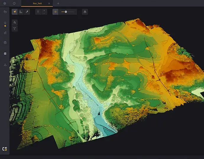
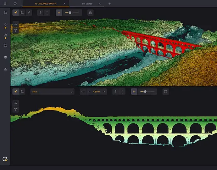

Overview
CloudStation handles the bathymetry-specific steps for you: extracting every echo from the full waveform, classifying the water surface, and correcting for refraction as the laser enters the water. Trajectories are processed inside CloudStation with SBG Qinertia or POSPac, then you export LAS or LAZ to the tools you already use.
Essential comes with every Navigator. Upgrade to Pro when you need strip adjustment, ground control constraints, contours and surface models, or to Ultimate for orthophotos and command-line batch processing.
Key features
✔
Automated full-waveform echo extraction
✔
Iterative water surface classification
✔
Water refraction correction, custom or presets
✔
Easy SBET generation with Qinertia or POSPac
✔
Georeference raw YellowScan data
✔
Visualise, measure, slice and remove outliers
✔
Colourise from orthophotos (all bundles) or camera images (Pro and Ultimate)
✔
Floating licence, works offline for 30 days, automatic updates
Best for
✔
Processing YellowScan Navigator data
✔
Survey teams who need strip adjustment and accuracy reports (Pro)
✔
High-volume or server processing (Ultimate)
What's in the box
✔
Automated full-waveform echo extraction
✔
Iterative water surface classification
✔
Water refraction correction, custom or presets
✔
Easy SBET generation with Qinertia or POSPac
✔
Georeference raw YellowScan data
✔
Visualise, measure, slice and remove outliers
✔
Colourise from orthophotos (all bundles) or camera images (Pro and Ultimate)
✔
Floating licence, works offline for 30 days, automatic updates
Specifications
Full-waveform echo extraction
All bundles
Water classification and refraction correction
All bundles
Georeference raw data, SBET with Qinertia or POSPac
All bundles
Remove outliers, colourise from orthophotos
All bundles
Import and display ground control
All bundles
Export LAS/LAZ and other formats
All bundles
Strip adjustment (robust and time-dependent)
Pro and Ultimate
Ground control to constrain accuracy
Pro and Ultimate
Strip adjustment accuracy report
Pro and Ultimate
Cut overlap and smoothing in one click
Pro and Ultimate
Colourise from camera images
Pro and Ultimate
Contour lines
Pro and Ultimate
Export DTM, DSM, DHM and hillshade
Pro and Ultimate
Automated trajectory QC
Pro and Ultimate
Orthophoto generation
Ultimate
Command-line batch processing (YTK)
Ultimate
Full-waveform LAS generation
Ultimate
Operating system
Windows 10/11
Bundle features from the YellowScan CloudStation datasheet (09/2025). Features are subject to change by YellowScan.
Related products


Enquire about
YellowScan CloudStation
Tell us which YellowScan system you run and how many people process data. We'll recommend the right CloudStation tier and quote the seats you need.
Call
1300 900 303