
YellowScan
•
Topo-bathymetric green LiDAR
YellowScan Navigator
A one-button green LiDAR for drones that maps the riverbed, the banks and everything in between in a single flight.
Wavelength
532 nm (green)
Max. depth
2 Secchi depths
Accuracy
3 cm (1σ at 50 m)
Weight
3.7 kg, battery excl.

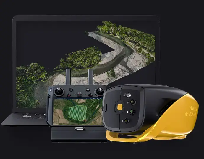


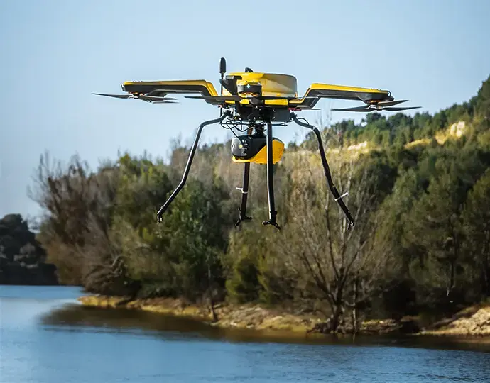
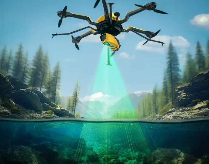
Overview
The Navigator fires up to 20,000 green laser shots a second and records the full waveform of every return, up to 15 echoes per shot. CloudStation then separates the water surface from the bed, corrects for refraction and exports one continuous point cloud from dry land into the water.
Depth depends on water clarity: about twice the Secchi depth. That makes it the right tool for clear rivers, shorelines, lakes, estuaries and gravel pits, and the wrong one for turbid tailings or silty dams. We'll check your water with you before you buy or hire.
Key features
✔
Topographic and bathymetric mapping in one pass
✔
Full waveform, up to 15 echoes per shot
✔
Up to 300,000 points per second
✔
One-button operation
✔
Integrated Gremsy mount
✔
Global shutter camera for true-colour point clouds
✔
SBG Quanta Micro GNSS/INS, post-processed in Qinertia
✔
Flies on multi-rotor or single-rotor drones
✔
CloudStation Essential included, with Pro and Ultimate upgrades
Best for
✔
Clear rivers and creeks
✔
Shorelines, estuaries and coastal shallows
✔
Lakes, ponds and gravel pits
✔
Flood modelling, erosion and habitat mapping, where you need the banks and the bed together
✔
Not suited to turbid water (use a drone echosounder)
What's in the box
✔
Topographic and bathymetric mapping in one pass
✔
Full waveform, up to 15 echoes per shot
✔
Up to 300,000 points per second
✔
One-button operation
✔
Integrated Gremsy mount
✔
Global shutter camera for true-colour point clouds
✔
SBG Quanta Micro GNSS/INS, post-processed in Qinertia
✔
Flies on multi-rotor or single-rotor drones
✔
CloudStation Essential included, with Pro and Ultimate upgrades
Specifications
Laser wavelength
532 nm (green)
Maximum depth
2 Secchi depths
Precision
3 cm (1σ at 50 m, nadir)
Accuracy
3 cm (1σ at 50 m, nadir)
Shots per second
Up to 20,000
Data generated
Up to 300,000 points per second
Echoes per shot
Full waveform, up to 15
Scanner field of view
40°
Scanning frequency
Up to 50 Hz, selectable
Point density
20 pts/m² at 80 m AGL and 5 m/s
Typical flight
80 m AGL at 5 m/s
Max. recommended flight height
100 m
Laser range
Up to 120 m
GNSS/INS
SBG Quanta Micro
RGB camera
Embedded global shutter camera
Weight
3.7 kg, battery excluded
Size
350 x 160 x 190 mm
Battery autonomy
45 min typical
Power consumption
120 W
Operating temperature
5 to 40 °C
Laser class
Class 3B, avoid direct exposure to the beam
Manufacturer figures (YellowScan, 09/2025). Precision and accuracy are measured on land. Bathymetric performance varies with water clarity.
Related products


Enquire about
YellowScan Navigator
Tell us about the water body and the drone you fly. We'll check water clarity and depth with you before recommending it, and help you lock in hire dates.
Call
1300 900 303