

Why fly the sensor instead of floating it
Boats and remote-control vessels need a safe place to launch and recover. Shallow, weedy or contaminated water can make that impossible. A drone only needs a small take-off area near the water, and it follows planned survey lines with high precision.
A radar altimeter and SkyHub's terrain following hold the drone at a constant height over the water, with altitude drift of about 10 cm. A standard barometric altimeter can drift several metres in a single flight.

Airborne bathymetric survey
10x faster and 2x more cost-efficient
According to SPH Engineering, a drone with an echosounder makes bathymetric surveys 10 times faster and 2 times more cost-efficient than a standard approach using a ship, a boat or an unmanned surface vehicle.
Deploy anywhere
Ideal for hard-to-reach locations such as steep coasts, mining pits, shallow water and terrain obstacles, as well as ponds, lakes and canals. No wide entry point to the water is needed, and places you can't reach on foot can be reached by drone.
Save time
Acquire data up to 10 times faster than traditional methods, thanks to easy transport and fast deployment.
Operate in harsh conditions
The drone works in unsafe and hazardous environments that people shouldn't approach, including contaminated water.
Precise measurements
Precise positioning along planned survey routes, at a constant speed and a set low altitude, gives high-accuracy measurements.
How it works
From flight plan to depth map
Step 1
Plan
Build the survey grid in UgCS with true terrain following. Choose continuous lines, waypoint "shots" for weedy water, or manual mode.
Step 2
Fly
The drone tows the echosounder at 0.5 to 0.7 m/s while the radar altimeter holds a constant height above the surface.
Step 3
Log
SkyHub stores geotagged depth, water temperature and tilt. With an RTK or PPK drone, positions are accurate to centimetres.
Step 4
Process
Export CSV, NMEA 0183 or SEG-Y for HydroMagic and other tools. Multibeam data is processed in BeamworX and exported as LAZ or GeoTIFF.
Products in this range


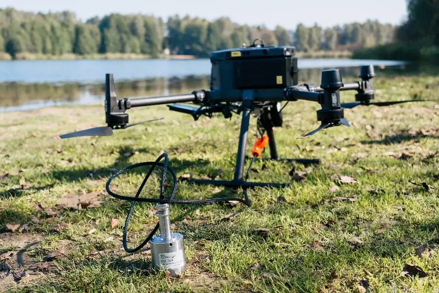

SkyHub and radar altimeter in every kit
The SkyHub onboard computer runs true terrain following, controls the payload and logs geotagged measurements, while the radar altimeter holds the drone at a constant height over the water.
Key specifications
Manufacturer figures. Measurement range is from the bottom of the transducer; in practice the sensor needs about 15 cm of water to stay submerged.
Single beam or multibeam?
Pick based on coverage, not just price
A single beam sounder measures one spot directly below the sensor. A multibeam returns a whole swath of points on every ping, so you get far denser coverage and fly fewer lines.
Multibeam accuracy depends more on knowing the speed of sound in the water, so plan on a sound velocity profile for engineering-grade work. Our team can walk you through it.
Choose single beam if
Choose multibeam if
Applications
What a drone echosounder can do
Maximum depth of up to 200 m, depending on the sensor. Best in still and slow-moving water. Strong currents are a limitation, since the sensor has to sit in the water. For weedy water, waypoint mode dips the sensor in at each point.
Also supported: drone GPR
SkyHub also integrates ground penetrating radar (52 to 124 MHz antennas, 6 to 15 m depth) for ice-covered water and other cases where an echosounder can't work. Ask us about it.

Enquire about drone echosounders
Tell us the water body, depth range and drone you fly, and we'll recommend a kit and send a quote.
Call
1300 900 303