Drone, LiDAR or boat: which suits your site?

There are three ways to measure a water body without putting people on the water: a drone echosounder, green (bathymetric) LiDAR, and a remote-control survey boat. All three work. The right one depends on your site, and three questions narrow it down fast.
The short answer
If your site looks like this | Start with |
Murky or turbid water, and nowhere safe to launch a boat | |
Clear, shallow water, and you need the banks as well as the bed | |
A larger or longer water body with a safe launch point |
If your site doesn't fit neatly into one row, keep reading. Plenty don't.
1. How clear is the water?
This is the first filter, because it rules green LiDAR in or out. A bathymetric LiDAR like the YellowScan Navigator uses a green laser that has to travel down through the water and back up again. It reaches about two Secchi depths, so if a Secchi disc disappears at 1.5 m, expect to measure to around 3 m.
Echosounders use sound instead of light, and sound doesn't care how murky the water is. Tailings ponds, silty farm dams, stormwater basins and most water after heavy rain are echosounder jobs, whether the sensor hangs from a drone or rides on a boat.
Not sure how clear your water is? Our guide Can green LiDAR see through my water? shows you how to check it in a few minutes.
2. Can you safely launch a boat?
A remote-control boat like McBathy needs somewhere to go in and come out: a ramp, a gentle bank or a jetty. McBathy is a one-person lift, which helps, but steep, soft or lined banks can still make launching unsafe.
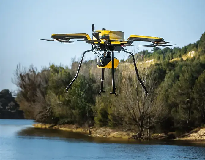
A drone only needs a small take-off area near the water. That is why drone echosounders are popular on tailings storage facilities, contaminated ponds and sites where the rules keep people well back from the edge. The sensor is towed on a cable just below the surface, and the drone follows the planned lines.
Two limits to know about. A towed sensor has to sit in the water, so strong currents are a problem. And in heavy weed, continuous towing doesn't work well, so the drone switches to waypoint mode and dips the sensor in at each point instead.
3. Do you need the banks in the same dataset?
Green LiDAR measures land and water in one pass, with no gap where they meet. For flood models, erosion studies and river work, that continuity is the main reason to choose it.
Echosounders, on a drone or a boat, measure the water only. If you need the banks too, pair them with a photogrammetry flight processed in Agisoft Metashape, or pick up the edge and key structures with a GNSS receiver. It's a common combination and it works well.
Other things that shape the choice
Depth. SPH single beam echosounders reach up to 200 m depending on the model, and the EchoNIMBUS-MBES multibeam 0.5 to 50 m. McBathy is built for shallow water under 100 m. LiDAR is limited by clarity, not by the sensor.
Size of the job. A drone tows the sensor slowly (0.5 to 0.7 m/s) and is limited by battery, which suits small to medium water bodies. McBathy runs for 1 to 4 hours, which suits longer runs and larger areas. The Navigator flies at about 5 m/s, so it covers clear water quickly.
Coverage. A single beam measures one spot below the sensor, so you run lines. A multibeam (EchoNIMBUS-MBES) or 3D sidescan (McBathy 3DSS) measures a swath on every ping, so you get denser data from fewer lines.
Sediment. If you need sediment thickness as well as depth, you want a dual-frequency single beam with a low-frequency channel, such as the SPH ECT D052S.
Repeat surveys. If you'll survey the same site every month or quarter, choose the method that is easiest to mobilise. That's usually the one with the least setup on the day.
Common sites and where we'd start
Site | Where we'd start | Why |
Tailings storage facility pond | Drone echosounder | Turbid water, no safe launch point, people kept off the water |
Flooded pit | Drone echosounder (single beam) | Steep walls and deep water. Single beam reaches up to 200 m |
Stormwater basin or sediment pond | Drone echosounder | Small, turbid and often weedy |
Farm dam or water storage with a ramp | RC survey boat or drone echosounder | Either works. The boat suits larger storages |
Harbour or channel after dredging | RC survey boat with 3DSS | Long runs, swath coverage and imagery of the bottom |
Clear river, creek or shoreline | Bathymetric LiDAR | Bed and banks in one flight |
Combining methods
Many jobs use two. A drone echosounder for the turbid pond and LiDAR for the embankments around it. LiDAR for the clear shallows of a river and a boat for the deeper pool. GNSS ties it all to the same datum. You don't have to pick one tool for the whole site.
What this means for your site
Send us four things: what the water body is and roughly how big, how deep you think it is, a photo of the water, and where you could launch a boat or take off. We'll tell you which method fits, what it would cost to buy, and whether you can hire it first to prove the workflow on your own site.
Want to talk about your site?
Send us a few details and we'll recommend the right setup, with a buy and a hire option.