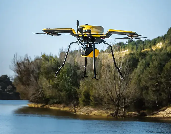
Surveying a tailings pond without putting anyone on the water

At the Oyu Tolgoi copper and gold mine in Mongolia, a pond inside the tailings storage facility (TSF) needs its depth checked regularly. Since 2025, Best Survey, an SPH Engineering partner, has been doing it with a drone instead of a boat.
The site and the challenge
The pond covers about 15,000 m². The site needed to track water levels, see how depth is distributed across the pond, and watch for uneven deposition and sediment build-up over time. That information feeds capacity checks and day-to-day operating decisions.
Getting it by boat was the problem. There was no safe place to launch a vessel of any size, crewed or uncrewed. Boat work would have put people at risk, some parts of the pond were hard to reach because of shallow zones and operating restrictions, and every repeat survey meant mobilising a boat all over again.
The equipment
DJI M350 RTK drone
SPH Engineering bathymetry kit with the Echologger ECT D052S dual-frequency single beam echosounder
SkyHub onboard computer, logging geotagged depths
UgCS for planning and flying the survey lines
How the survey runs
The team plans structured survey lines over the pond in UgCS, so every survey covers the pond the same way. The drone flies the lines with the echosounder towed just below the surface, while the crew stays outside the survey area for the whole mission.
The result
Each survey produces a georeferenced, colour-coded depth map of the pond, with no water access and no boat. Because the lines are planned once and flown the same way each time, the workflow fits the site's ongoing monitoring, and one survey is easy to compare with the next.
Why it matters for Australian sites
Australian TSF ponds face the same problem: soft or lined embankments, no safe launch point, and site rules that keep people away from the water's edge. Tailings water is also far too turbid for green LiDAR, so an acoustic sensor is the way in.
Two details from this job are worth copying. First, the sensor. The ECT D052S's 50 kHz channel passes through soft, light sediment to the harder bottom beneath, while the 200 kHz channel reads the top of the bed, so the difference between the two gives you an estimate of sediment thickness as well as depth. Second, repeatability. Planning the lines once and flying them the same way every time is what turns a one-off survey into monitoring you can rely on.
Summarised from SPH Engineering's article "UAV-Based Bathymetry Supports Ongoing TSF Pond Monitoring at Oyu Tolgoi Mine" (30/04/2026). Survey by Best Survey, Mongolia. Read the full case study. |
Planning a TSF survey? We supply the SPH ECT D052S kit, train your team on it, and can talk you through hire or a demonstration. Get in touch.
Want to talk about your site?
Send us a few details and we'll recommend the right setup, with a buy and a hire option.